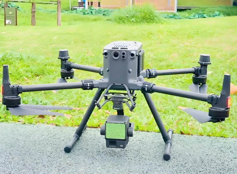


This product adopts GNSS RTK high-precision positioning technology to ensure the accuracy of large-scale mapping. With a scanning width of 15m at 50m flight height, it can complete survey of 50,000 square meters per hour, greatly improving work efficiency. The IP67 protection rating can adapt to various harsh outdoor environments. It supports real-time data return, allowing users to monitor the scanning progress in real time. It is compatible with most mainstream industrial drones, and can be quickly installed and disassembled, reducing the preparation time before operation. The built-in high-performance data processing chip can realize real-time point cloud stitching, reducing later processing workload.
The scanning accuracy is ±2cm at 100m, with a scanning width of 15m when flying at 50m height. It supports a maximum payload of 5kg, and is compatible with DJI, Autel and other mainstream industrial drones. The data processing delay is less than 2 seconds, and it supports exporting files in LAS, LAZ, DSM and DEM formats. It adopts GNSS RTK high-precision positioning system to ensure the accuracy of large-scale mapping. The protection rating is IP67, and the working temperature range is -10℃ to 50℃. It is powered by the drone's battery pack, and can work continuously for the whole flight time of the drone (about 30 minutes per flight). It is equipped with a quick-release mounting bracket, which can be installed on the drone in 5 minutes.
This product is suitable for large-scale terrain survey, urban planning and design, forest resource inventory, land use status monitoring, disaster area assessment, large-scale park and campus mapping and other scenarios. It is widely used in survey and design institutes, environmental protection companies, urban management departments and other enterprises and institutions. It can replace traditional manual ground survey, greatly reducing labor intensity and shortening the project cycle.


 Post RFQ


 Chat
Chat


 ALL CATEGORIES