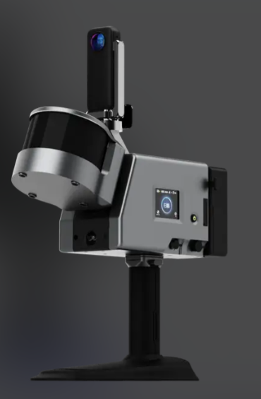


This product adopts non-contact laser scanning technology, equipped with high-precision CMOS sensors and self-developed point cloud denoising algorithm to effectively filter ambient stray light interference and ensure the purity of scanning data. It has an 8-hour long-lasting lithium battery, supports outdoor operation without power supply, and is equipped with one-click automatic point cloud stitching function, which can complete multi-station scanning data fusion without manual adjustment. Compared with traditional surveying instruments, this device can be used quickly without professional calibration, greatly reducing personnel training costs, and supports wireless data backhaul to view scanning progress and achievement previews on supporting mobile terminals in real time, solving the problem of lagging data export of traditional surveying equipment.
The whole machine weighs only 1.2kg, with a non-slip silicone grip suitable for long-term handheld operation. The scanning accuracy can reach ±0.5mm per 10m scanning distance, meeting the accuracy requirements of most small and medium-sized surveying projects. The maximum scanning area can reach 3m×3m for a single scan, supporting flexible ranging adjustment from 0.1m to 50m. The protection rating is IP54, which can cope with light rain and snow and dust environments. It is equipped with USB-C fast charging interface and Wi-Fi 6 wireless transmission module, supporting fast linkage with mobile phones, tablets and computers. It is compatible with mainstream engineering software such as AutoCAD and Revit, and can directly export standard format files suitable for BIM modeling. The supporting mobile APP supports real-time preview of scanning point cloud data and one-click export of survey reports.
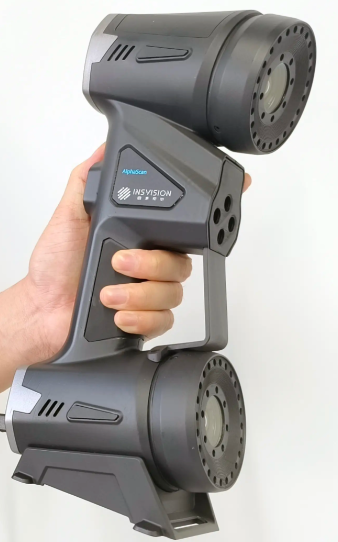
It is mainly applicable to small and medium-sized construction site survey, interior decoration lofting, small cultural relics digital scanning, outdoor terrain simple survey and other scenarios. The architectural decoration team can use this device to quickly collect 3D data of walls and ceilings to generate accurate decoration lofting drawings; small cultural relics protection institutions can use it to complete digital archiving of small ornaments and sculptures; outdoor survey teams can quickly complete topographic survey of small plots and generate high-precision topographic point cloud models. At the same time, the device is suitable for temporary field operation scenarios, without the need to build complex fixed scanning brackets, and only needs handheld operation to complete data collection.


 Post RFQ


 Chat
Chat


 ALL CATEGORIES