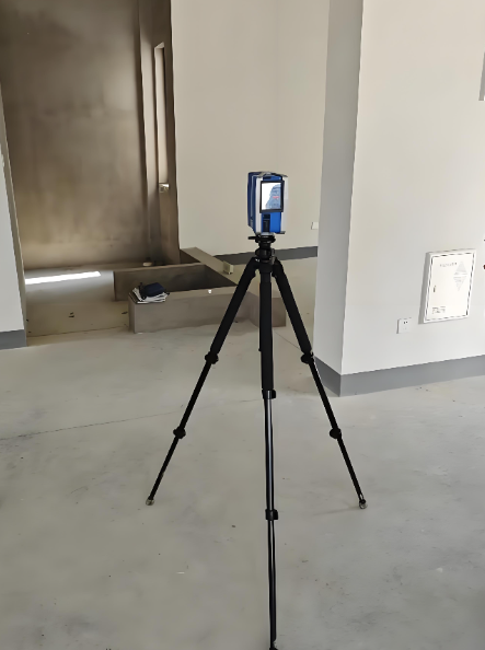
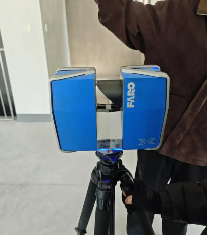


The scanner adopts a lightweight design, optimized for multi-rotor UAV mounting, with a total weight of only 2.1kg, adapting to the load capacity of mainstream industrial UAVs. It is equipped with a built-in centimeter-level RTK positioning module, which can realize accurate geotagging of scanning data and ensure the spatial coordinate accuracy of point cloud data. It supports 5G real-time data backhaul, allowing real-time viewing of scanning progress and generated terrain models on the ground control station without waiting for the end of the flight to export data. The equipment is equipped with a low-power laser scanning system, which can match the endurance time of the UAV, and supports automatic route planning scanning, which can complete full coverage scanning of large-area areas according to the preset flight path without manual intervention. Compared with traditional manual field survey, this equipment can increase survey efficiency by more than 10 times, and greatly reduce the safety risks of field operations.
It is compatible with mainstream industrial multi-rotor UAVs such as DJI M300 and Autel EVA II Pro, and is equipped with a built-in centimeter-level RTK positioning module, with scanning accuracy up to ±2cm per 100m scanning distance. A single flight can cover a maximum survey area of 50 acres, supporting scanning resolution adjustment from 50m to 300m flight altitude. The protection rating is IP54, which can cope with outdoor light rain and snow and dust environments. It is equipped with a 5G wireless data transmission module, supporting real-time backhaul of scanning point cloud data to the ground control station. It supports standard survey format output such as DSM (Digital Surface Model) and DOM (Digital Orthophoto Map), and is compatible with mainstream GIS software such as ArcGIS and QGIS. The supporting ground control software supports automatic route planning, scanning progress monitoring and one-click generation of survey reports. It is equipped with a special quick-release bracket, which can quickly complete installation and disassembly with the UAV.
It is mainly applicable to large-scale topographic survey, forest resource survey and reserve estimation, open-pit mine slope monitoring, urban planning area 3D modeling and other large-scale outdoor scenarios. Land surveying and mapping departments can use this equipment to quickly complete topographic survey of county-level administrative regions and generate high-precision topographic models for urban planning; forestry departments can use it to complete forest area measurement and forest stock estimation without manual walking into the forest area; open-pit mining enterprises can use it to complete slope monitoring regularly and generate high-precision 3D models for safety control. At the same time, the equipment supports night scanning operation, and can complete survey work in low-light environment with infrared fill light.


 Post RFQ


 Chat
Chat


 ALL CATEGORIES