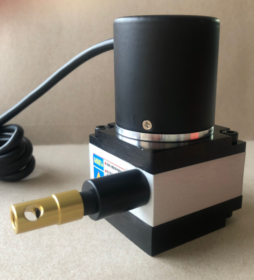
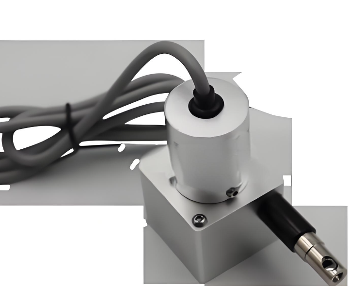


This cable-type displacement gauge adopts 316 stainless steel shell, with IP68 protection grade, which can be immersed in water for a long time and adapt to the harsh water environment of hydrological projects. It uses marine grade anti-corrosion treatment, which can resist the corrosion of water and seawater, and has a long service life of more than 8 years. The cable length can be customized from 1~50m according to different monitoring scenarios, which can meet the monitoring needs of different distances. It supports two output signals of RS485 and 4~20mA, which can be connected to the industrial control system and hydrological monitoring platform to realize remote data transmission. The measurement accuracy is ±0.1mm, which can meet the requirements of hydrological project deformation monitoring. It has a stable and reliable structure, and is not easy to be affected by external environmental interference.
The measurement range is 0~1000mm, and the measurement accuracy is ±0.1mm. The cable length can be customized from 1~50m, and the cable is made of high-strength stainless steel wire rope. The protection grade is IP68, which can be immersed in water up to 10m deep for a long time. The housing is made of 316 stainless steel, with marine grade anti-corrosion treatment, and can adapt to salt spray and water corrosion in hydrological environments. The operating temperature range is -25℃~70℃, and it can adapt to the temperature changes of different hydrological seasons. It supports two output signals: RS485 Modbus protocol and 4~20mA current signal, with a transmission distance of up to 1000m for RS485. The pull force range is 0~50N, which can meet the monitoring needs of general deformation projects. The overall size of the sensor is 150mm×80mm×60mm, and the weight is about 800g.
It is mainly suitable for deformation monitoring of hydrological projects such as dams, levees, mountain slopes, reservoir banks and water gates, as well as settlement monitoring of high-rise building foundations and landslide monitoring of mountain areas. It can be used by water conservancy management departments, hydrological monitoring stations, geological disaster prevention institutions and other units to carry out real-time monitoring and early warning of deformation of water conservancy and geological facilities, ensuring the safety of flood control and geological disaster prevention.


 Post RFQ


 Chat
Chat


 ALL CATEGORIES